Beverley and North Holderness Internal Drainage Board
Beverley and North Holderness Internal Drainage Board - Information
The Board, was formed out of three old Drainage Boards going back to 1766. The original Beverley Board merged with the Holderness Board and subsequently the Beverley and Barmston Board, itself going back to 1798. The Board's District lies within the East Riding of Yorkshire on the north bank of the Humber. The Board's District generally lies as a square block between the Cities of Kingston upon Hull, Beverley and Driffield with the eastern edge level with the village of Catwick, however there are eastern extensions towards Dunnington, Skipsea. There is the secondary leg to the coast which extends to Barmston sands.
The 1993 Act provided a boundary change when the majority of the City of Hull was removed from the
Boartd's District. The majority of the District discharges into Environment Agency maintained high level, Main Rivers that
pass through the District.
The Beverley IDB is a member of the Association of Drainage Authorities.
| Constituted | March 1981 |
| Area | 23,822ha |
| Length of Maintained Watercourses | 263km |
| Area of Agricultural Land | 22,008ha |
| Area of non-Agricultural Land | 1,814ha |
| Number of Pumping Stations | 1 |
| Area Dependent upon Pumping | 16,675ha |
| Towns and Villages in and around the District | Aike Arnold Arram Barmston Beeford Beswick Beverley Bilton Brandesburton Brigham Burton Agnes Catwick Coniston Driffield Dunnington Dunswell Fraisthorpe Ganstead Gembling Gransmoor Great Kelk Harpham Hempholme Hull Hutton Cranswick Kilnwick Kirkburn Leconfield Leven Lissett Little Kelk Lockington Long Riston Lowthorpe Meaux Nafferton North Frodingham Routh Scorborough Skearne Skipsea South Skirlaugh Southburn Swine Thearne Tickton Ulrome Upton Watton Wawne Weel Wilfholme Winsford Woodmansey |
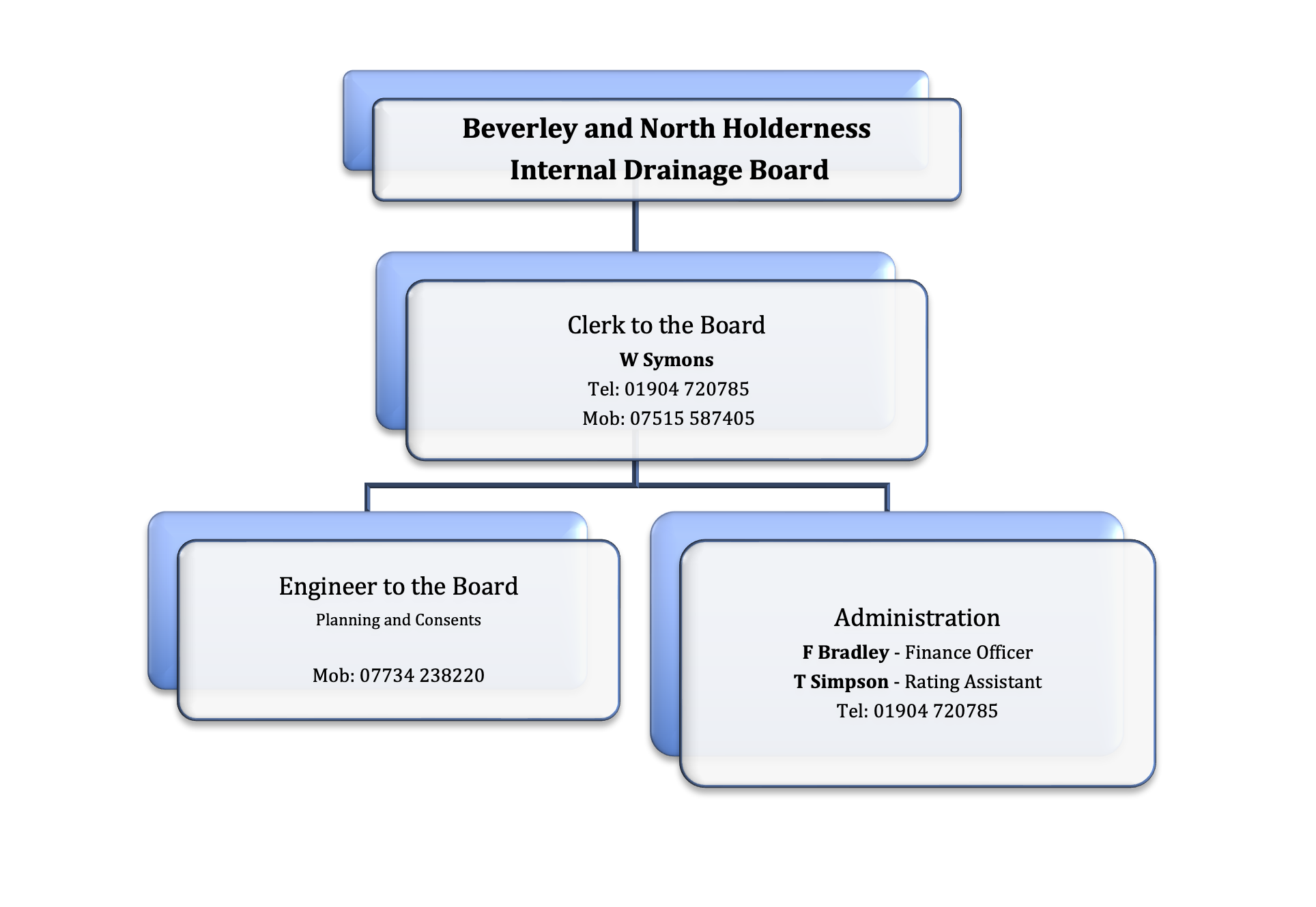
Organisation Chart